


DAYTON OUTSIDE Voting District, Sheridan County, Wyoming
About
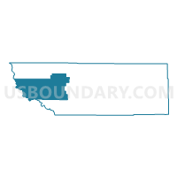
Outline

Summary
| Unique Area Identifier | 698858 |
| Name | DAYTON OUTSIDE Voting District |
| County | Sheridan County |
| State | Wyoming |
| Area (square miles) | 352.10 |
| Land Area (square miles) | 351.92 |
| Water Area (square miles) | 0.18 |
| % of Land Area | 99.95 |
| % of Water Area | 0.05 |
| Latitude of the Internal Point | 44.80683640 |
| Longtitude of the Internal Point | -107.48305200 |
Maps

Graphs
Select a template below for downloading or customizing gragh for DAYTON OUTSIDE Voting District, Sheridan County, Wyoming


Neighbors
Neighoring Voting District (by Name) Neighboring Voting District on the Map
- BECKTON SCHOOL Voting District, Sheridan County, WY
- BIG HORN WOMENS CLUB Voting District, Sheridan County, WY
- DAYTON INSIDE Voting District, Sheridan County, WY
- LOVELL Voting District, Big Horn County, WY
- RANCHESTER OUTSIDE Voting District, Sheridan County, WY
- SHELL Voting District, Big Horn County, WY
- SLACK SCHOOL (PARKMAN) Voting District, Sheridan County, WY
Top 10 Neighboring County Subdivision (by Population) Neighboring County Subdivision on the Map
- North Big Horn CCD, Big Horn County, WY (5,571)
- Central Big Horn CCD, Big Horn County, WY (3,555)
- Sheridan West CCD, Sheridan County, WY (2,628)
Top 10 Neighboring Place (by Population) Neighboring Place on the Map
Top 10 Neighboring Unified School District (by Population) Neighboring Unified School District on the Map
- Sheridan County School District 2, WY (24,064)
- Sheridan County School District 1, WY (4,623)
- Big Horn County School District 4, WY (2,244)
Top 10 Neighboring State Legislative District Lower Chamber (by Population) Neighboring State Legislative District Lower Chamber on the Map
Top 10 Neighboring State Legislative District Upper Chamber (by Population) Neighboring State Legislative District Upper Chamber on the Map
Top 10 Neighboring 111th Congressional District (by Population) Neighboring 111th Congressional District on the Map
Top 10 Neighboring Census Tract (by Population) Neighboring Census Tract on the Map
- Census Tract 9628, Big Horn County, WY (5,571)
- Census Tract 6, Sheridan County, WY (4,697)
- Census Tract 9627, Big Horn County, WY (3,555)
Top 10 Neighboring 5-Digit ZIP Code Tabulation Area (by Population) Neighboring 5-Digit ZIP Code Tabulation Area on the Map
- 82801, WY (24,558)
- 82431, WY (3,552)
- 82426, WY (2,644)
- 82839, WY (1,153)
- 82836, WY (1,073)
- 82838, WY (268)
- 82441, WY (250)
- 82844, WY (35)